Democracy in Toronto took another important step forward yesterday, as MPP Mitzie Hunter’s private member’s bill empowering Toronto to set up a ranked ballot system for municipal elections passed through second reading, and was sent to the Ontario legislature’s Standing Committee on Social Policy for further study.
LINK: Mitzie Hunter Statement re RaBIT (Ranked Ballot Initiative)
The bill still has a long way to go (see How an Ontario Bill becomes Law; and even then Toronto City Council will still have to vote to adopt such a system), but the volunteers behind the Ranked Ballot Initiative of Toronto should take a day or two to celebrate this key milestone.
Pushing through any electoral reform is a daunting prospect filled with hurdles. I’m truly impressed by the progress that has been made so far by RaBIT to get it to this stage.
It requires a real persistence, focus, and sense of civic dedication to patiently manoeuvre a change like this through the different layers of government and community, over the course of several years. I would compare the process to walking a tightrope in slow motion. Each delicate step is vital, and at any point the whole thing could be derailed.
Keep at it, RaBIT! Follow the progress of Bill 166 here.
See previously:
Come to my PodCamp talk on Maps and Digital History!
This Sunday afternoon I’m giving a talk at PodCamp Toronto, a community-driven technology ‘unconference’.
I’ll be discussing my Historical Maps of Toronto project as an informal case study. We’ll cover maps in general, digital history, and challenges overcome in the course of the project.
You’re cordially invited to come! My talk is this Sunday, February 23 at 2pm, in the Rogers Communications Centre - 80 Gould St.
The event is free to attend and is taking place at Ryerson University over the course of this weekend. Be sure to check out the full schedule of speakers and sessions—it promises to be a fun time. More about PodCamp Toronto here.
See you there!
 |
| Come to my talk at PodCamp Toronto! It’s free! |
I’ll be discussing my Historical Maps of Toronto project as an informal case study. We’ll cover maps in general, digital history, and challenges overcome in the course of the project.
You’re cordially invited to come! My talk is this Sunday, February 23 at 2pm, in the Rogers Communications Centre - 80 Gould St.
The event is free to attend and is taking place at Ryerson University over the course of this weekend. Be sure to check out the full schedule of speakers and sessions—it promises to be a fun time. More about PodCamp Toronto here.
See you there!

You’ll Love Exploring Toronto From 1818 To 2012 With This Amazing Interactive Map. Check Out 1947!
Apologies for the Buzzfeed-style headline, but this is a project I want to share widely. You’ll enjoy it, I promise.
Click to launch the Toronto Historic Maps viewer by Chris Olsen.
Easily pan around (Google-maps style), zoom in and out, and best of all—switch between years to watch how the city evolves over time. For optimal results, use a decent computer with a modern browser and a fast internet connection. Requires Flash (sorry), and may take a few seconds to initially load.
To my delight, another aficionado with a passion for maps recently leveraged that work to create something new and marvellous. This is what happens with shared historical information and open data—everyone benefits.
In my blog post about Goad’s Atlas of the City of Toronto—Online!, I challenged readers to “imagine a jazzed-up, interactive version, or a gigantic ‘all in one file’ image carefully stitched together”.
That line apparently resonated with Chris Olsen, an analyst at ESRI (the premier Geographical Information System technology vendor), and he nimbly took up my challenge.
Olsen had previously created well-received historical map viewers for Cleveland and Pittsburgh. He learned of my Goad and Historical Maps of Toronto projects, and decided to implement a map viewer instance for Toronto, seeing as the source images had conveniently been assembled in one spot by yours truly.
The amount of work he invested is prodigious. To create the site, Olsen georeferenced and then melded together map plates from the Goad fire insurance plans (1880, 1889, 1913 and 1924). He also incorporated maps from 1818, 1842, and aerial photographs from 1947. At my urging he added the 1858 Boulton Atlas of the City of Toronto (a predecessor map to the Goad plans). I’ve contacted the City of Toronto Archives to find out if we can obtain the source imagery for some of their post-1947 aerial photography series so they can be added to the project (No response yet, but we’ll see what happens).
[Note to techies: Yes, Olsen’s georeferenced files are public and free to use. Depending on the application, users can access them in ArcMap by connecting here, or if within a web application, here.]
I have often envisioned doing something like this, but was stymied by the technical and resource requirements to get it together. I’m incredibly happy that someone else felt the same way—and actually did something about it.
The value in this project is the ability to scrutinize how Toronto buildings, neighbourhoods and streetscapes change between years. Even in the gap between 1947 and 2012, the differences—as well as the things that stay the same—can be astonishing.
Mr. Olsen is to be thanked for gifting us with this engrossing and novel way of exploring old Toronto. It pleases me to have contributed (even if merely peripherally) to his endeavour. This sort of initiative is exactly why organizing the maps together was so important to me in the first place—it enables people to find, use, and build on the resources in new and exciting ways. History belongs to all of us!
Readers, let me know in the comments if you discover anything neat. I know you will.
See Also
Historical Maps of Toronto
Goad’s Atlas of the City of Toronto—Online!
Fort York and Garrison Common Maps
 |
| Toronto Historic Map viewer—an interactive online map |
Click to launch the Toronto Historic Maps viewer by Chris Olsen.
Easily pan around (Google-maps style), zoom in and out, and best of all—switch between years to watch how the city evolves over time. For optimal results, use a decent computer with a modern browser and a fast internet connection. Requires Flash (sorry), and may take a few seconds to initially load.
Background context
Over the last couple of years, I put together several online projects relating to historical maps of Toronto. A key motivation was to aggregate maps from different institutional sources, as previously they were difficult to discover, navigate and browse. My hope was to provide a simple, easy-to-use entry point for researchers, students, and other Toronto history enthusiasts to access these important documents from our past.
To my delight, another aficionado with a passion for maps recently leveraged that work to create something new and marvellous. This is what happens with shared historical information and open data—everyone benefits.
In my blog post about Goad’s Atlas of the City of Toronto—Online!, I challenged readers to “imagine a jazzed-up, interactive version, or a gigantic ‘all in one file’ image carefully stitched together”.
That line apparently resonated with Chris Olsen, an analyst at ESRI (the premier Geographical Information System technology vendor), and he nimbly took up my challenge.
Olsen had previously created well-received historical map viewers for Cleveland and Pittsburgh. He learned of my Goad and Historical Maps of Toronto projects, and decided to implement a map viewer instance for Toronto, seeing as the source images had conveniently been assembled in one spot by yours truly.
The amount of work he invested is prodigious. To create the site, Olsen georeferenced and then melded together map plates from the Goad fire insurance plans (1880, 1889, 1913 and 1924). He also incorporated maps from 1818, 1842, and aerial photographs from 1947. At my urging he added the 1858 Boulton Atlas of the City of Toronto (a predecessor map to the Goad plans). I’ve contacted the City of Toronto Archives to find out if we can obtain the source imagery for some of their post-1947 aerial photography series so they can be added to the project (No response yet, but we’ll see what happens).
 |
| Recognize this famous Toronto landmark? |
[Note to techies: Yes, Olsen’s georeferenced files are public and free to use. Depending on the application, users can access them in ArcMap by connecting here, or if within a web application, here.]
I have often envisioned doing something like this, but was stymied by the technical and resource requirements to get it together. I’m incredibly happy that someone else felt the same way—and actually did something about it.
The value in this project is the ability to scrutinize how Toronto buildings, neighbourhoods and streetscapes change between years. Even in the gap between 1947 and 2012, the differences—as well as the things that stay the same—can be astonishing.
Mr. Olsen is to be thanked for gifting us with this engrossing and novel way of exploring old Toronto. It pleases me to have contributed (even if merely peripherally) to his endeavour. This sort of initiative is exactly why organizing the maps together was so important to me in the first place—it enables people to find, use, and build on the resources in new and exciting ways. History belongs to all of us!
Readers, let me know in the comments if you discover anything neat. I know you will.
See Also
Historical Maps of Toronto
Goad’s Atlas of the City of Toronto—Online!
Fort York and Garrison Common Maps
Forcing Unicyclists Onto the Road is a Bad Idea
Open Letter
Attention: Councillor Denzil Minnan-Wong (Chair), Councillor Michelle Berardinetti, Councillor Janet Davis, Councillor Mark Grimes, Councillor Mike Layton, & Councillor John Parker |
| Don’t force me to ride on the road! |
I am writing with respect to City of Toronto PWIC agenda item PW28.2, Electric Bikes - Proposed Policies and By-laws.
The proposal before the Committee revises the municipal definition of “bicycle” to include unicycles. An unintentional side effect of this change will be to force unicyclists to ride on the road with other vehicles. This is problematic. I strongly recommend that the Public Works Committee remove unicycles from the updated bicycle definition.
Forcing unicycles onto the road is a bad idea
There are two major issues with the proposed revision:
- Unicycles have just one wheel. Bicycles, by any reasonable etymological examination of the term, have two.
Imprecision and terminological inexactitude are key factors affecting bylaw enforcement, which led to the e-bike policy review in the first place. A self-contradictory definition impedes the goal of bylaw clarity. - More seriously, the relative speed differential between unicycles and regular bicycles is significant—forcing unicycles to operate under the same conventions as bicycles is inconsistent with the policy’s stated aim of promoting safety.
The average speed of a standard 20 inch unicycle is approximately 7-8km/h (if the rider is in shape) — not much faster than brisk walking speed. By contrast, nearly 90% of bicycle commuters have an average speed of 18-25km/h or greater (per the cyclist speed profile provided in this agenda item’s background file). This represents a material gap in average speeds between the two vehicle types. The speed gap between unicycles and motor vehicles is even larger.
Speed differentials between e-bikes and regular bicycles were cited as a key factor in shaping the proposed policy changes—why create another instance of the very problem we are trying to solve?
 |
| One wheel. |
 |
| Two wheels. See the difference? |
Context and background information
Up to this point, unicycles have mostly existed in an ambiguous discretionary area not particularly subject to strict statutory regulation—with respect to roadways and sidewalks in the City of Toronto. However, the proposed policy revision before the Committee arbitrarily includes unicycles as part of a harmonized definition of “bicycle”:
The General Manager, Transportation Services recommends that:
City Council amend the City of Toronto Municipal Code Chapter 608, Parks; Municipal Code Chapter 886, Footpaths, Pedestrian Ways, Bicycle Paths, Bicycle Lanes and Cycle Tracks; and Municipal Code Chapter 950, Traffic and Parking to delete the existing definitions of bicycles, as described in Appendix A attached to this report, and replace them with the following harmonized definition of bicycle:
BICYCLE – Includes a bicycle, tricycle, unicycle, and a power-assisted bicycle which weighs less than 40 kg and requires pedalling for propulsion (“pedelec”), or other similar vehicle, but does not include any vehicle or bicycle capable of being propelled or driven solely by any power other than muscular power.
(Recommendation #1, from PW28.2)
The inclusion of unicycles may seem innocuous, but it would have a damaging spillover impact in the context of Municipal Code § 950-201: Regulations for bicycles and mopeds, subsection C(2), where the recommended textual change is that:
No person age 14 and older shall ride a bicycle on a sidewalk of any highway, except for those locations designated in § 886-6, of Municipal Code Chapter 886, Footpaths, Pedestrian Ways, Bicycle Paths, Bicycle Lanes and Cycle Tracks.
(Recommendation #5 & Appendix C, from PW28.2)
In other words, according to the proposed changes, persons (age 14 and older) would be prohibited from legally riding unicycles on the sidewalk—if unicycles are included in the definition of bicycle.
Rather than force unicyclists onto the roadways or bike lanes, where potentially dangerous speed differentials and vehicular behavioural expectations are at play, I recommend that unicyclists should continue to be given the leeway to exercise responsible judgment as to where they should ride most safely and appropriately with respect to others, whether that be on the road or the sidewalk.
Importantly, note that unicyclists riding on the sidewalk are already subject to Ch.950, Article III, Subsection 950-300, which states:
No person shall ride upon or operate a bicycle [with a tire size less than or equal to 61.0 centimetres (24 inches)—this provision to be deleted per PW28.2 Rec. #5, Appendix C], skateboard, in-line skates or roller-skates, coaster, scooter, toy vehicle, toboggan, sleigh, or any similar device on a sidewalk recklessly or negligently or at a speed or in a manner dangerous to the public, having regard to circumstances.
To reiterate, unicyclists will continue to be subject to municipal bylaw enforcement if they are riding recklessly or negligently. Further regulation is not required at this time.
Conclusions
- The harmonized municipal definition of ‘bicycle’ should not include unicycles.
- Forcing unicyclists to ride on the road is likely to create the very speed differential issues which the proposed revisions are in principle trying to solve.
- Unicyclists on the sidewalk are already subject to bylaw enforcement prohibiting reckless or negligent riding, and do not require further regulation.
- Number of GTA unicycle-related traffic accidents and infractions in 2013: Zero. Let’s keep it that way.
The unicycle community in Toronto—while diverse and eclectic—is generally well behaved with respect to observance of bylaws and traffic conventions. It would be quite unfortunate for this policy change to unwittingly create scofflaws out of this playful and carefree group of environmentally-friendly citizens. It would be even more unfortunate if the safety of this group and others were to be compromised by careless inclusion in the bylaw.
Thank you for your attention to this serious matter. I look forward to your considered response,
Nathan Ng
Toronto One-Wheel Exhibition League
File images of unicycle and bicycle courtesy of Wikipedia under the Creative Commons Attribution 3.0 Unported license [link].
Pretending I’m Walter White from Breaking Bad
I took my pants off on Bloor St. today. It was pretty chilly.
Here’s my ridiculous, rushed attempt at recreating some iconic Breaking Bad imagery. How’d I do?
I didn’t have a lot of time to get it done, but—sometimes you just do things for a laugh.
Walt and Jesse’s first lab rolls through town
The highly-recognizable camper from the hit AMC television series Breaking Bad was appearing in various places around the city, as a promotional marketing push accompanying the release on DVD/Blu-Ray.
The tour is being touted on Facebook and Twitter as:
The yellow suits are from later seasons of Breaking Bad.
When Walt and Jesse cook in the camper during the first season, they’re basically only wearing green aprons and gas masks. Having the yellow suits around violates the continuity—which is important if you’re a true geek like yours truly. It’s just wrong.*
So I thought I’d do my own guerilla shoot, after discovering where the camper was appearing today. The result is as above.
Green shirt: check. Facial hair & glasses: check. [Dollar store] Gun: check. Tighty-whiteys and argyle socks: check!
Note to Sony overlords: the onsite staff explicitly told me that they “could not condone” the shot and they refused to assist me in any way (though they didn’t interfere, either). You could tell them they should’ve embraced the fan spirit and helped out!
It’s amusing that the subject material of the show is so incredibly graphic, yet when it comes to marketing, any hint of edginess is verboten. For heaven’s sake, you are pretending to cook meth inside the camper, as part of this promo campaign! A guy standing outside in his underwear isn’t going to get you fired. It’s a funny set of standards to uphold, don’t you think?
Thanks to random-passerby ‘Alex’ for taking the photos. Several people I asked were not comfortable—as soon as I mentioned I was going to remove my pants, they declined, duh—which I found unsurprising but still interesting from a cultural perspective. It’s just underwear, folks. But the schoolyard taboo remains strong.
If any photoshoppers out there want to help me make this a little more ludicrous with effects or messing around with the hues/saturation, please be my guest. It’s rather incongruous to have ‘Holt Renfrew’ in the background instead of the desert...
* In season 2 episodes 5 and 9 Walt and Jesse do wear pale grey zip up 'clean suits'. But the bright yellow suits are from season 3 episode 6 onward...
Here’s my ridiculous, rushed attempt at recreating some iconic Breaking Bad imagery. How’d I do?
 |
| “Let’s cook!” —outside the Breaking Bad RV |
 |
| The classic image from the first episode of the series: Walter White in his tighty-whiteys. |
I didn’t have a lot of time to get it done, but—sometimes you just do things for a laugh.
Walt and Jesse’s first lab rolls through town
The highly-recognizable camper from the hit AMC television series Breaking Bad was appearing in various places around the city, as a promotional marketing push accompanying the release on DVD/Blu-Ray.
The tour is being touted on Facebook and Twitter as:
“Your chance to interact with the vehicle used as Walt and Jesse’s first lab and where the story began.”I saw a whole series of photographs of people posing around and inside the camper wearing yellow Haz-Mat suits. My immediate reaction as a fan of the show was, those shots aren’t authentic!
 |
| Oh dear. |
When Walt and Jesse cook in the camper during the first season, they’re basically only wearing green aprons and gas masks. Having the yellow suits around violates the continuity—which is important if you’re a true geek like yours truly. It’s just wrong.*
So I thought I’d do my own guerilla shoot, after discovering where the camper was appearing today. The result is as above.
 |
| “I just want you to know, no matter how it may look, I only had you in my heart.” |
Green shirt: check. Facial hair & glasses: check. [Dollar store] Gun: check. Tighty-whiteys and argyle socks: check!
Note to Sony overlords: the onsite staff explicitly told me that they “could not condone” the shot and they refused to assist me in any way (though they didn’t interfere, either). You could tell them they should’ve embraced the fan spirit and helped out!
It’s amusing that the subject material of the show is so incredibly graphic, yet when it comes to marketing, any hint of edginess is verboten. For heaven’s sake, you are pretending to cook meth inside the camper, as part of this promo campaign! A guy standing outside in his underwear isn’t going to get you fired. It’s a funny set of standards to uphold, don’t you think?
 |
| The yellow suits are fun, but... And nevermind the barrels. |
Thanks to random-passerby ‘Alex’ for taking the photos. Several people I asked were not comfortable—as soon as I mentioned I was going to remove my pants, they declined, duh—which I found unsurprising but still interesting from a cultural perspective. It’s just underwear, folks. But the schoolyard taboo remains strong.
If any photoshoppers out there want to help me make this a little more ludicrous with effects or messing around with the hues/saturation, please be my guest. It’s rather incongruous to have ‘Holt Renfrew’ in the background instead of the desert...
* In season 2 episodes 5 and 9 Walt and Jesse do wear pale grey zip up 'clean suits'. But the bright yellow suits are from season 3 episode 6 onward...
Time to resign, Mayor Ford
Mayor Ford, you have besmirched the reputation of this fair city with your behaviour. It is time for you to do the right thing and resign.
As a citizen, I am profoundly disappointed, and embarrassed. Toronto deserves better from its elected Chief Magistrate.
Resign, Mayor Ford. And get help. Your ‘leadership’ of this city is a sad, shambling joke, and you have lost whatever trust was ever placed in you.

See:
Toronto Police have the video showing the Mayor smoking crack
Editorial positions of the major Toronto papers:
(And I’m sure even the most rudimentary googling will bring up a host of other related stories)
 |
| Rob Ford meeting with drug dealer Sandro Lisi, from Toronto Police surveillance |
As a citizen, I am profoundly disappointed, and embarrassed. Toronto deserves better from its elected Chief Magistrate.
Resign, Mayor Ford. And get help. Your ‘leadership’ of this city is a sad, shambling joke, and you have lost whatever trust was ever placed in you.
See:
Toronto Police have the video showing the Mayor smoking crack
Editorial positions of the major Toronto papers:
- For the sake of Toronto, Mayor Rob Ford should resign (Toronto Star)
- Toronto deserves better than Ford (Globe & Mail)
- For the good of Toronto, Rob Ford must step down (National Post)
- Rob Ford needs to stand down (Toronto Sun)
(And I’m sure even the most rudimentary googling will bring up a host of other related stories)
A Pair of Wistful Farewells
Goodbye Iringa, Toka and Thika. It looks like the three surviving elephants of the Toronto Zoo are finally going to be leaving us. A challenging journey to California awaits them, sometime before the end of this month.
The move follows a protracted and often farcical tussle that has lasted years. I hope that the elephants don’t suffer during the trip. Regardless of how you felt about their captivity here, they were amazing and majestic to witness in person, and I thank them for their service.
Goodbye OLF
The other farewell I want to make is to the Ontario Longboarding Forum, a.k.a. OLF, which shut down about a month and a half ago.
OLF was an online bulletin board forum for skateboarders. It was a key hub for the community and an important gathering place for skaters of all ages and backgrounds.
My half-hearted description fails to do it justice, unfortunately. At a different time I might have written a lengthy panegyric, but I haven’t the energy. With the rise of Facebook and other social networks, as well as my own declining skating, I have to admit I drifted away over the past couple of years.
Nevertheless OLF was an influential piece of the Toronto skate scene for almost a decade, and I’m happy that I got to participate however peripherally as the site waxed — and waned — in popularity.
I made a lot of friends on OLF. I’m grateful to Chris Barrett and his conspirators for running and administering the site over all these years. Thanks Chris, Adam, Bill, and the other mods. You guys were great, and I salute your efforts and passion. Be proud of your contribution.
There’s a brief history of the origins of OLF in Michael Brooke’s examination of the Toronto longboarding scene, Half the Hills All the Skills; the entire article is well worth reading.
Meanwhile the scene has moved on. More and more people are skating, and OLF’s time came and went. Like the sand patterns in a Zen garden, perhaps OLF’s existence was meant to be ephemeral—no trace of it remains except in our shared memories.
See previously
No more elephants at the Toronto Zoo
City Council Votes to Send Elephants Away
Past Skate Articles From Me
• The Return of Longboard Haven Skate Shop
• Profile: Justin Readings, Downhill Skateboarder
• Is skateboarding illegal in Toronto?
• The Toronto Board Meeting: A Short History
• The rise of Patrick Switzer, Downhill Skateboarder
• Letter to Councillor Mary-Margaret McMahon: Why Jeopardize the Ashbridges Bay Skate Park?
• Concrete Wave’s Lame ‘Pin-Up’ Cover
• The Banana Split -- Four Years Later
• Grappling with another longboarding death
• Our first longboarding tragedy
• Speed! Thrills! Women! FUBU Skate Race Recap
 |
| Goodbye elephants! You’ll be missed. |
The move follows a protracted and often farcical tussle that has lasted years. I hope that the elephants don’t suffer during the trip. Regardless of how you felt about their captivity here, they were amazing and majestic to witness in person, and I thank them for their service.
Goodbye OLF
The other farewell I want to make is to the Ontario Longboarding Forum, a.k.a. OLF, which shut down about a month and a half ago.
OLF was an online bulletin board forum for skateboarders. It was a key hub for the community and an important gathering place for skaters of all ages and backgrounds.
 |
| The classic OLF banner with its square-jawed Aryan skaters |
My half-hearted description fails to do it justice, unfortunately. At a different time I might have written a lengthy panegyric, but I haven’t the energy. With the rise of Facebook and other social networks, as well as my own declining skating, I have to admit I drifted away over the past couple of years.
 |
| Founder Chris Barrett’s notice about the Ontario Longboarding Forum’s demise |
Nevertheless OLF was an influential piece of the Toronto skate scene for almost a decade, and I’m happy that I got to participate however peripherally as the site waxed — and waned — in popularity.
I made a lot of friends on OLF. I’m grateful to Chris Barrett and his conspirators for running and administering the site over all these years. Thanks Chris, Adam, Bill, and the other mods. You guys were great, and I salute your efforts and passion. Be proud of your contribution.
There’s a brief history of the origins of OLF in Michael Brooke’s examination of the Toronto longboarding scene, Half the Hills All the Skills; the entire article is well worth reading.
Meanwhile the scene has moved on. More and more people are skating, and OLF’s time came and went. Like the sand patterns in a Zen garden, perhaps OLF’s existence was meant to be ephemeral—no trace of it remains except in our shared memories.
See previously
No more elephants at the Toronto Zoo
City Council Votes to Send Elephants Away
Past Skate Articles From Me
• The Return of Longboard Haven Skate Shop
• Profile: Justin Readings, Downhill Skateboarder
• Is skateboarding illegal in Toronto?
• The Toronto Board Meeting: A Short History
• The rise of Patrick Switzer, Downhill Skateboarder
• Letter to Councillor Mary-Margaret McMahon: Why Jeopardize the Ashbridges Bay Skate Park?
• Concrete Wave’s Lame ‘Pin-Up’ Cover
• The Banana Split -- Four Years Later
• Grappling with another longboarding death
• Our first longboarding tragedy
• Speed! Thrills! Women! FUBU Skate Race Recap
I went to jail today...
This afternoon I went to jail. It was a fascinating trip — but one I’d obviously rather not repeat.
The occasion was the public opening of the massive, newly constructed Toronto South Detention Centre.
Slated to begin accepting inmates later this fall, the $594m facility can house 1,650 offenders, plus another 320 in the connected Toronto Intermittent Centre (by comparison, the Don Jail’s capacity was 562, though counts often exceeded that).
The maximum-security jail features state-of-the-art construction, even boasting a LEEDS Silver certification. Its modern design (by Zeidler Partnership Architects) has been specifically implemented to control and minimize the day-to-day movement of offenders within different areas of the building.
As a (mostly) law abiding citizen who values his liberty and personal privacy, let me tell you that I would not want to involuntarily spend any time in this building. Touring the jail firsthand will make you reflect on how we treat prisoners, as well as contemplate the tension between rehabilitation and punishment — regardless of how you feel about the efficacy of the system.
The site of the jail was formerly occupied by the Mimico Correctional Centre; it has a correctional history dating back at least 100 years.
Public tours are continuing Saturday and Sunday this weekend; I recommend it if you’re at all interested in Ontario’s correctional infrastructure and approach. It was particularly edifying, from the perspective that every aspect of the building reflected a practical ‘designed’ purpose.
“How do you build and scale a safe living space where you can control and supervise every waking moment of 1,650 men?”
Observationally I found that people’s inclinations about jail were reinforced by the tour (i.e. if you think humane treatment and a focus on rehabilitation is important, you still thought that at the end; if you think prisons are where criminals should rot away suffering for their misdeeds, ditto).
More reading & photos
Although the general public isn’t allowed to take in any cameras, the media was permitted to photograph the interior of parts of the building. You can see more of the jail at these links:
The occasion was the public opening of the massive, newly constructed Toronto South Detention Centre.
 |
| Toronto South Detention Centre main entrance |
Slated to begin accepting inmates later this fall, the $594m facility can house 1,650 offenders, plus another 320 in the connected Toronto Intermittent Centre (by comparison, the Don Jail’s capacity was 562, though counts often exceeded that).
 |
| A model aerial view shows the sheer scope of the complex. Image courtesy EllisDon |
The maximum-security jail features state-of-the-art construction, even boasting a LEEDS Silver certification. Its modern design (by Zeidler Partnership Architects) has been specifically implemented to control and minimize the day-to-day movement of offenders within different areas of the building.
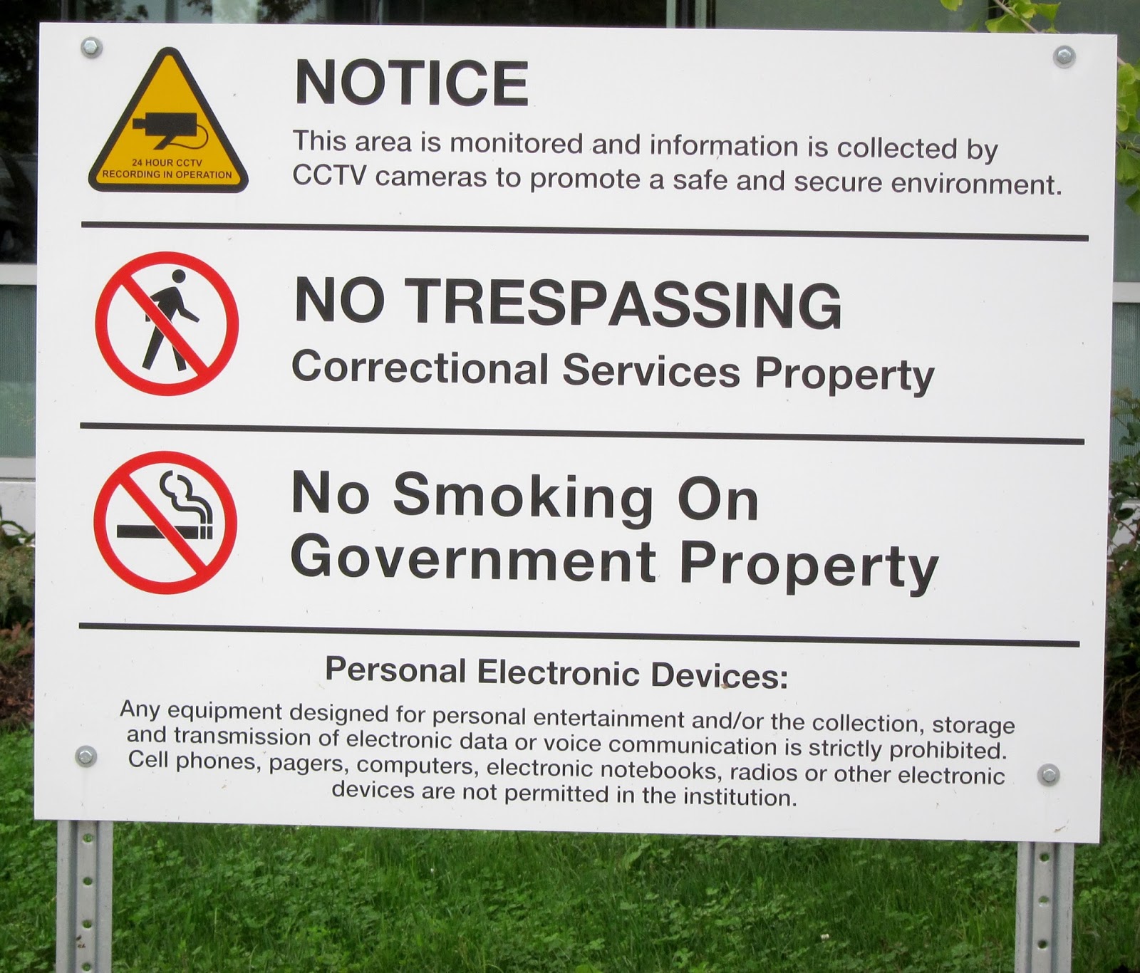 |
| Warning sign at the TDSC |
The site of the jail was formerly occupied by the Mimico Correctional Centre; it has a correctional history dating back at least 100 years.
 |
| Imagine spending two whole years confined to this block. Photo by Tyler Anderson / National Post. View original here. |
Public tours are continuing Saturday and Sunday this weekend; I recommend it if you’re at all interested in Ontario’s correctional infrastructure and approach. It was particularly edifying, from the perspective that every aspect of the building reflected a practical ‘designed’ purpose.
“How do you build and scale a safe living space where you can control and supervise every waking moment of 1,650 men?”
Observationally I found that people’s inclinations about jail were reinforced by the tour (i.e. if you think humane treatment and a focus on rehabilitation is important, you still thought that at the end; if you think prisons are where criminals should rot away suffering for their misdeeds, ditto).
More reading & photos
Although the general public isn’t allowed to take in any cameras, the media was permitted to photograph the interior of parts of the building. You can see more of the jail at these links:
- A Tour of the New Toronto South Detention Centre (Torontoist)
- Toronto’s new $594-million ultra-modern jail features ‘fresh air’ rooms, flat-screen TVs (National Post)
- Video: Inside Toronto's new maximum security detention centre (Globe and Mail)
A pleasant surprise...
Yesterday I was idly leafing through the summer issue of Spacing magazine, only to discover I’m in it! It’s kind of funny to find myself on the opposite page of Steve Munro, the city’s wise luminary on transit.

The referenced blog post was one I wrote last year, What Does A Decade of TTC Metropass Designs Look Like? Check it out!

The referenced blog post was one I wrote last year, What Does A Decade of TTC Metropass Designs Look Like? Check it out!
Want to go to a Toronto Historic Museum for Free?
Here’s a good deal for you! How would you like a free family admission to any City of Toronto Historic Museum? Toronto Historic Sites is giving away passes for a limited time.
The passes are valid for a single family visit before October 31, 2013, to one of the ten museums, which include Fort York, Colborne Lodge, and Mackenzie House. It’s a great way to see the city’s rich history firsthand, and to learn about its past.
Follow this link to catch the offer while it’s on.
 |
| Hurry while supplies last... |
Follow this link to catch the offer while it’s on.
How to climb for 40 days and 40 nights
For whatever reason, this dusty two-year-old video of yours truly has recently gone (weakly) viral; about 80,000 people have now seen me climbing on the treadwall at Boulderz.
[LINK]
According to YouTube’s analytics, this has resulted in over 60 thousand estimated viewing minutes—roughly 40 days’ worth of climbing. No wonder I feel tired.
The traffic seems to have mostly originated from this post on the Cheezburger network:

as well as the videos page on MSN (where another 10,000 views have accumulated:

Sadly, I’m not a regular at Boulderz—a great gym incidentally—so my endurance hasn’t gotten any better. Ha. At least it’s not an embarrassing moment.
Here’s my original post about this video: Humiliation Machine at Boulderz
While we’re on the topic I might as well link to two other moments of unintentional 'fame' (yes I suffer from self-absorption):
Other Climbing Posts of Interest
Why is Tree Climbing Illegal in Toronto?
The Secret Life of Iyma Lamarche, Rock Climber
Hurrah For The Ontario Access Coalition
Bring a Bouldering World Cup to Toronto
Interview with Rock Oasis' Founder and President
[LINK]
According to YouTube’s analytics, this has resulted in over 60 thousand estimated viewing minutes—roughly 40 days’ worth of climbing. No wonder I feel tired.
The traffic seems to have mostly originated from this post on the Cheezburger network:

as well as the videos page on MSN (where another 10,000 views have accumulated:

Sadly, I’m not a regular at Boulderz—a great gym incidentally—so my endurance hasn’t gotten any better. Ha. At least it’s not an embarrassing moment.
Here’s my original post about this video: Humiliation Machine at Boulderz
While we’re on the topic I might as well link to two other moments of unintentional 'fame' (yes I suffer from self-absorption):
Other Climbing Posts of Interest
Why is Tree Climbing Illegal in Toronto?
The Secret Life of Iyma Lamarche, Rock Climber
Hurrah For The Ontario Access Coalition
Bring a Bouldering World Cup to Toronto
Interview with Rock Oasis' Founder and President
Martin Luther King’s 'I Have a Dream' Speech Should Belong to Everyone, not SONY
 |
| MLK orating Aug. 28, 1963 |
What I find absurd is that the King speech — one of the most important civil rights speeches in history — is under copyright in the U.S. and will be so until the year 2038.
[LINK: MLK I Have a Dream speech]
Free at last, free at last? Nope. Pay a licensing fee to use it in its entirety. Want to listen to the whole 17 minutes, legally? Shell out $20 for the DVD. Pay out enough money, and you can use the speech in an advertisement like Alcatel did in 2001...
[LINK: Alcatel I Have a Dream ad]
The speech should be in the public domain. It belongs to all of us. Yes, I understand the desire to keep anyone from misappropriating the text. But I think a larger social good comes from people being able to access, share, and interpret the text in their own way. The content transcends.
P.S. SONY is the current copyright enforcer. SONY! [I believe the King family retains ownership of the copyright itself]
More reading
Why MLK’s 'Dream' Is So Hard to Find Online [National Journal]
‘I Have a Dream’ speech still private property [Washington Post]
Liona Boyd — The Toronto Song! Cheese or Magic?
There’s been some harsh criticism levelled at Liona Boyd’s newly released tune celebrating our city, The Toronto Song!, premiering at the start of this year’s Taste of the Danforth festival.
Torontoist calls the treacly melody “bizarre.” Spacing magazine describes it as “maybe the most soul-less piece of schlock ever produced.” Other online commenters use the adjectives surreal, embarrassing, lame, and awful.
I say, stuff it, haters.
Boyd’s work here is so earnest I can’t bring myself to dislike it; my usual jaded cynicism is defeated by the video’s wholesome sincerity. Yes, the song is hokey and saccharine. But that’s how these songs are supposed to be.
It’s meant for families and tourists. It’s meant to welcome strangers and embrace us all.
Compare past songs with similar intents, and you’ll find they share a penchant for wide-eyed boosterism:
Just like these other 'anthems', Boyd’s song reflects a certain time and place, and conveys a relentlessly enthusiastic perspective about Toronto. And perhaps one day we’ll look back and laugh together.
Listen to: Liona Boyd being interviewed about the song on 680 News (To download: right-click --> save as; MP3)
See also: Ed Keenan’s reaction.
Bonus links
Torontoist calls the treacly melody “bizarre.” Spacing magazine describes it as “maybe the most soul-less piece of schlock ever produced.” Other online commenters use the adjectives surreal, embarrassing, lame, and awful.
I say, stuff it, haters.
 |
| Liona Boyd: so in love with Toronto |
It’s meant for families and tourists. It’s meant to welcome strangers and embrace us all.
Compare past songs with similar intents, and you’ll find they share a penchant for wide-eyed boosterism:
- Theme for Ontario Place / A place to stand
- The original Blue Jays theme (not ok blue jays)
Just like these other 'anthems', Boyd’s song reflects a certain time and place, and conveys a relentlessly enthusiastic perspective about Toronto. And perhaps one day we’ll look back and laugh together.
Listen to: Liona Boyd being interviewed about the song on 680 News (To download: right-click --> save as; MP3)
See also: Ed Keenan’s reaction.
Bonus links
- The Toronto Song - Three Dead Trolls in a Baggie
- The Anthem - Kardinal Offishall
- I Get On (The TTC) - I Put on (for my city) - Randal Paul and Syruslife
- Spadina Bus - Shuffle Demons
What would Google Maps for Toronto look like in 1858?
It amuses me to present the following zoomable, scrollable online version of the 1858 Boulton Atlas of the City of Toronto and Vicinity, surveyed and compiled by W.S. and H.C. Boulton.
Scroll around, and zoom in & out using your mouse—just like you would in Google maps!
View the map in full page mode here.

I’m not sure how useful this is as a historical tool, but it merits at least 30 seconds’ worth of hey this is neat. Try your scroll wheel! (Sorry iPad users; this demo requires a full featured browser)
Thanks go to Carrie Martin for volunteering to help stitch this together and putting up with my nattering edits.
[Note: if you’re into historical maps, you might want to check out my larger projects:
But I wasn’t entirely satisfied with the way it was presented. Although I created a key map to help users, I still found it awkward to look up an individual plate.
I wanted to make a composite version of the Atlas—that is, to stitch together all of the plates to form a super-map of the entire city.
Of course I’m not the first person to have this notion. In 2009 E.R.A. Architects created a huge wall-map version for their Harbourfront exhibit, Found Toronto.
I asked the kind folks at E.R.A. if they still possessed the original file from the exhibit, and if I could acquire it to put online. They were extremely helpful, and graciously took the time to search for it, but unfortunately, all they had left on their system was a low resolution copy.
Similarly, a composite was done for the book Historical Atlas of Toronto by Derek Hayes, but the resolution was scaled down (as it only needed to fit in a coffee-table size book) and all the useful detail was lost.
So, I decided to recreate my own stitched-together-version. Lacking a computer with sufficient horsepower, I inveigled my friend Carrie to help me out — she actually did the labour. Thanks again Carrie! [A small nod also goes to the several others who volunteered to assist]
The resulting image is modestly hefty—24,108 x 11,405 (about 275 megapixels) in size.
The Boulton maps are each lithographed onto separate physical plates. Although they are ostensibly all drawn at the same scale, they are not exactly so (at least not with modern precision in mind). As well, the physical plates have aged differently depending on their individual exposure to light and air, resulting in colour contrasts between plates. Finally, the digital scans to which I had access were not all at the same scale (major pain in the neck!).
As a result, the stitching is far from seamless. Imagine putting together a puzzle where the pieces don’t actually fit together.
We tried our best to preserve alignments where possible, but (deliberately) sacrificed accurate placement along certain streets/seams. Subtle changes in scan orientation wind up being grossly magnified when trying to stitch together multiple plates.
In my view the sole truly egregious problem is just east of Carlton and Parliament; the street formerly known as Elm gets semi-obliterated; everything else is ‘close enough’. Queen and (the modern) College St., being the two horizontal seams, suffer the most. Meanwhile several north/south streets (e.g. Yonge) are allowed to wax and wane in width (to a degree that some may find disturbing) in order to force neighbouring streets to align correctly.
I’m comfortable with the minor distortions introduced; it’s a lot harder than it looks! If you think you can do a better job, you’re welcome to download the plates and try it yourself. Anyway, please blame Carrie for any errors (haha).
The scan images are courtesy of the Toronto Public Library: 912.71354 B594 1858.
Enjoy!
[personal aside to any geographers / cartographers out there: Yes, I know this should properly be done as some kind of layer in ArcGIS, then re-made into new map tiles, for browsing via open street maps or whatever, which would allow all kinds of interesting data overlays etc. You are cordially invited to invest the effort to do so. I’ll probably get around to it, if and when zoom.it ceases working.]
Scroll around, and zoom in & out using your mouse—just like you would in Google maps!
View the map in full page mode here.
I’m not sure how useful this is as a historical tool, but it merits at least 30 seconds’ worth of hey this is neat. Try your scroll wheel! (Sorry iPad users; this demo requires a full featured browser)
Thanks go to Carrie Martin for volunteering to help stitch this together and putting up with my nattering edits.
[Note: if you’re into historical maps, you might want to check out my larger projects:
Update: Media Coverage
This post generated a fair amount of online discussion and coverage. Here’s a sample of the chatter:- BlogTO: Google Maps in Toronto—the 1858 version
- Torontoist: Extra Extra—Old Toronto Maps
- Huffington Post: Toronto 1858 'Google' Map Is A History Nerd's Dream
The Background Story
Earlier this spring, I made an online gallery of the Boulton Atlas, a set of 30 detailed map plates of Toronto created in 1858 by WS Boulton.But I wasn’t entirely satisfied with the way it was presented. Although I created a key map to help users, I still found it awkward to look up an individual plate.
I wanted to make a composite version of the Atlas—that is, to stitch together all of the plates to form a super-map of the entire city.
Of course I’m not the first person to have this notion. In 2009 E.R.A. Architects created a huge wall-map version for their Harbourfront exhibit, Found Toronto.
I asked the kind folks at E.R.A. if they still possessed the original file from the exhibit, and if I could acquire it to put online. They were extremely helpful, and graciously took the time to search for it, but unfortunately, all they had left on their system was a low resolution copy.
Similarly, a composite was done for the book Historical Atlas of Toronto by Derek Hayes, but the resolution was scaled down (as it only needed to fit in a coffee-table size book) and all the useful detail was lost.
So, I decided to recreate my own stitched-together-version. Lacking a computer with sufficient horsepower, I inveigled my friend Carrie to help me out — she actually did the labour. Thanks again Carrie! [A small nod also goes to the several others who volunteered to assist]
The resulting image is modestly hefty—24,108 x 11,405 (about 275 megapixels) in size.
Challenges
There were some unavoidable issues and compromises.The Boulton maps are each lithographed onto separate physical plates. Although they are ostensibly all drawn at the same scale, they are not exactly so (at least not with modern precision in mind). As well, the physical plates have aged differently depending on their individual exposure to light and air, resulting in colour contrasts between plates. Finally, the digital scans to which I had access were not all at the same scale (major pain in the neck!).
As a result, the stitching is far from seamless. Imagine putting together a puzzle where the pieces don’t actually fit together.
We tried our best to preserve alignments where possible, but (deliberately) sacrificed accurate placement along certain streets/seams. Subtle changes in scan orientation wind up being grossly magnified when trying to stitch together multiple plates.
In my view the sole truly egregious problem is just east of Carlton and Parliament; the street formerly known as Elm gets semi-obliterated; everything else is ‘close enough’. Queen and (the modern) College St., being the two horizontal seams, suffer the most. Meanwhile several north/south streets (e.g. Yonge) are allowed to wax and wane in width (to a degree that some may find disturbing) in order to force neighbouring streets to align correctly.
I’m comfortable with the minor distortions introduced; it’s a lot harder than it looks! If you think you can do a better job, you’re welcome to download the plates and try it yourself. Anyway, please blame Carrie for any errors (haha).
The scan images are courtesy of the Toronto Public Library: 912.71354 B594 1858.
Enjoy!
[personal aside to any geographers / cartographers out there: Yes, I know this should properly be done as some kind of layer in ArcGIS, then re-made into new map tiles, for browsing via open street maps or whatever, which would allow all kinds of interesting data overlays etc. You are cordially invited to invest the effort to do so. I’ll probably get around to it, if and when zoom.it ceases working.]
Incredible zoomable high-resolution panorama of Tokyo
My friend Elise sent me a link to this eye-popping 360° panoramic photo of Tokyo. It’s 150 gigapixels and zoomable. Best viewed in full resolution mode (not in the tiny version in this post):
[LINK]
Is this cool or what?!
[The reason she sent me the link is because I’m trying to put together a much simpler zoomable map of the 1858 Boulton Atlas of the City of Toronto]
More info: io9 spoke with Jeffrey Martin, the creator.
[LINK]
Is this cool or what?!
[The reason she sent me the link is because I’m trying to put together a much simpler zoomable map of the 1858 Boulton Atlas of the City of Toronto]
More info: io9 spoke with Jeffrey Martin, the creator.
Subscribe to:
Posts (Atom)